Claudette is likely to form and make landfall in the US this week
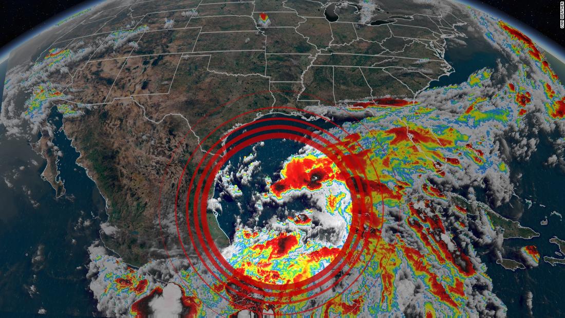
The system is currently stationed over the Bay of Campeche in the Gulf of Mexico and southern Mexico as a collection of disorganized showers and thunderstorms.
The National Hurricane Center (NHC) puts the chance of tropical development within the next 48 hours at 70%, and a 90% chance within the next five days in the Gulf.
If the disturbance strengthens according to forecasts, it will be named Claudette — the third named storm of the 2021 season.
Uncertainty is high regarding the track of the storm since it has not formed yet, but current forecasts have the system reaching the northern Gulf Coast this weekend. Landfall is possible from the Texas coast to Florida.
“A tropical depression is likely to form by late Thursday or on Friday when the low moves across the western Gulf of Mexico,” the NHC said in its discussion.
Current model guidance is indicating that the storm will track toward the western Gulf Coast, near Texas and Louisiana. There is considerable uncertainty in the tracks, but if this scenario plays out, areas vulnerable to flooding could see the greatest impacts of the system.
Flooding rainfall is the greatest concern, warns NWS
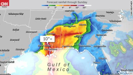
Louisiana, Mississippi, Alabama, Georgia and the Florida Panhandle are expecting heavy rain.
“We’ve had a good amount of rain just over the last months,” said NWS Lake Charles, Louisiana, meteorologist Chanelle Stigger. “We had heavy rain, and we saw over a foot of rain just in the Lake Charles area itself. The soils have been pretty saturated.”
Stigger said that rainfall “would be our greatest concern.”
This storm forming in the Gulf brings back haunting memories to people in Louisiana.
Rainfall from this weekend’s system could range from 7 to 10 inches from New Orleans to Mobile, Alabama.
“These amounts could cause widespread flooding as well as rises on area rivers to flood stage or higher,” NWS New Orleans warns.
Fortunately, current models are showing the system move through the region at around 10 to 15 mph. “That bodes well, generally speaking, to keep this from being an event like Harvey,” said NWS New Orleans.
Flooding will only be one of the main worries as the weekend approaches.
“Surf heights quickly increase through the day on Friday with 6+ feet possible by Friday afternoon,” NWS Mobile stated in their forecast discussion.
Rip tides caused by the southerly winds and swells from the storm will likely impact the coastal areas. Strong wind concerns could be possible and will become more evident as the disturbance enters warm water in the Gulf.
![]()


