Analysis: Ida turns New York into a front line of the climate crisis
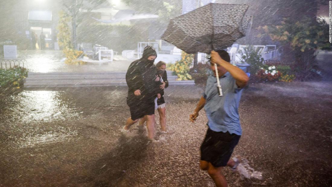
Officials in New York appeared totally caught off guard by the floods. Meteorologists — who knew storms and floods were on their way, even roughly how much rain would fall — were also surprised at the storm’s pace.
“It’s dangerous. We’re seeing a kind of rainfall — we almost never see this kind of speed with which the rain has come,” New York City Mayor Bill de Blasio said, urgently calling on everyone to stay at home.
New York Governor Kathy Hochul said she could not guarantee responders could rescue people that may be stuck in their cars “if it starts floating away like a boat on a river.”
Eight people have already died in New York and New Jersey, which are both under a state of emergency.
“What is so surprising is the time span of the rainfall and the area impacted,” said CNN Weather’s Michael Guy.
“It is such a large area across the northeast, and it only happened within a span of a few hours. That’s nothing that we have seen, especially in this region of the country.”
Like with several weather events over the summer across the Northern Hemisphere, Ida has smashed records in some areas by a huge margin.
Wednesday was the rainiest day on record for Newark, New Jersey, which saw 8.41 inches of rain recorded. That’s nearly 25% above the previous record, set in 1977.
In New York City, more rain fell in a single hour (3.15 inches) than at any point in the city’s weather records, which go back to the 1800s. New York’s Central Park recorded 7.13 inches of rain, nearly doubling the previous record set in 1927 for the same date, the National Weather Service New York reported.
New York City’s flash flood emergency status is the first issued in its history.
What’s the role of climate change?
Globally, extreme rainfall events — including those in Germany and China in recent months — are becoming more common because of human-caused global warming, scientists say.
A recent UN climate report said that “the frequency and intensity of heavy precipitation events have increased since the 1950s over most land area.”
“Warmer air can contain more water vapor than cooler air. Global analyses show that the amount of water vapor in the atmosphere has in fact increased over both land and oceans,” the report says.
In terms of hurricanes, climate change is making them more dangerous. They are producing more rainfall, moving slower once they make landfall and generating larger storm surges along the coast. Hurricane Ida was a prime example of those changes, and scientists say storms like this will become more common as the planet warms.
Scientists are now able to analyze exactly how much of a role climate change is likely to have played in a particular weather event. It’s too early to make such an estimate for Ida, but trends in hurricanes of this force suggest a link.
“What we can say, without doing a dedicated attribution study, is that major hurricane occurrences (categories 3-5) have increased in recent decades, which cannot be explained by natural variability alone,” Friederike Otto, who co-leads the World Weather Attribution initiative, told CNN in an email.
“Specifically, from event attribution, we do note that when hurricanes occur, the rainfall associated with them is more intense because of human-induced climate change, and Ida will not be an exception.”
While there is less certainty about the impacts of climate change on wind speed and some other factors, there is high confidence that the translation speed — how fast the whole system moves — of hurricanes has slowed, Otto said.
“This is important as it means the cyclones hang around for longer and thus can also cause more damage.”
What can we do?
Climatologist Kim Cobb, director of the Global Change Program at the Georgia Institute of Technology, warned that New York, like many cities, was clearly not prepared to deal with climate-related and weather disasters such as Storm Ida.
“I don’t think that what we’re seeing today is emblematic of a climate-ready city in New York and, obviously, we have a story coming out from cities across the world — from communities out west grappling with wildfires that are linked to climate change,” Cobb told CNN.
“We’re just coming out of Ida’s devastation across the southeast US — Louisiana and Mississippi — infrastructure that is not ready for our climate of now, let alone the climate of tomorrow. These kinds of climate impacts are going to worsen with each additional increment of warming.”
That would require deep cuts to greenhouse gas emissions and for the world to wean off unabated fossil fuels.
Reaching net zero by 2050 could contain average global temperature rise to 1.5 degrees Celsius above pre-industrial levels, which scientists say would stave off some of the more catastrophic climate change impacts than the world if currently experiencing. Warming is already at around 1.2 degrees C.
CNN’s Brandon Miller and Rachel Ramirez contributed to this report.
![]()


