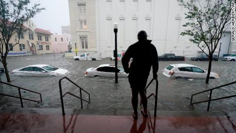
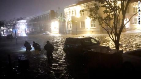
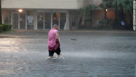
Floodwaters have turned streets into rivers as the storm crawls at an agonizingly slow pace over the Gulf Coast
The storm has spurred water rescues, sapped power, dropped trees and left serious flooding as it crawled at an agonizingly slow pace since Wednesday morning.
“We anticipate the evacuations could literally be in the thousands” David Morgan, sheriff of Florida’s Escambia County which includes Pensacola, said of rescuing people in flooded neighborhoods.
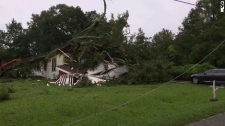
Water rescues have been reported in several coastal Alabama and Florida Panhandle communities. That includes Alabama’s Gulf Shores, where homes flooded and trees toppled onto roofs, city spokesman Grant Brown said.
“It’s going to be a long time, folks, … to come out of this thing,” the sheriff said.
With Sally’s slow pace — now around 5 mph — some areas already have collected more than 24 inches of rain and could receive up to 35 inches by storm’s end.
A flood emergency and a half million with no power
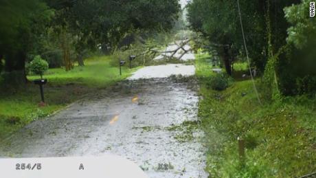
Floodwaters have turned streets into rivers in Pensacola, images from the Associated Press show. Pieces of hazardous debris “have become too numerous to list,” police there warned.
“Nothing is going to go away anytime soon,” National Hurricane Center Director Ken Graham told CNN on Wednesday morning. “The winds, the torrential rainfall, the slow movement and the storm surge — this is a dangerous situation all around.”
On Florida’s Pensacola Beach, sounds of transformers exploding and metal scraping along the ground — debris from torn roofs — could be heard early Wednesday.
Rainfall totals of 10 to 35 inches are possible from Mobile Bay to Tallahassee, Florida, forecasters say.
Central Alabama and central Georgia could eventually see 4 to 12 inches of rain, with significant flash flooding possible. Parts of the Carolinas could receive 4 to 9 inches of rain by later in the week.
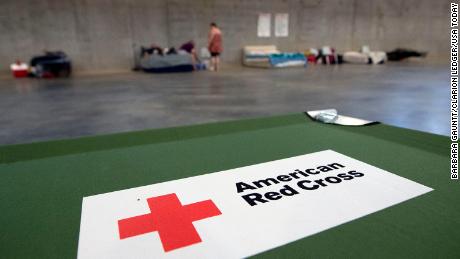
Mandatory evacuations were ordered for much of the coast and low-lying areas from Mississippi to Florida, and shelters opened to accommodate evacuees.
People have been calling for help in both states
Many people were calling 911 for help leaving flooded areas in Alabama and Florida Wednesday morning, several local governments reported.
In Alabama’s Baldwin County between Mobile and Pensacola, people were calling 911 for help, but emergency workers couldn’t immediately respond early Wednesday because conditions were unsafe, county emergency management deputy director Jenni Guerry said.
Damage and flooding in Alabama
In Alabama, the floor and walls on the 16th floor of a hotel on the northern rim of Mobile Bay groaned as Sally made its way ashore.
The building shook as if in the throes of an extended, low-grade earthquake, and sturdy windows seemed poised to pop out, a CNN team there said.
At the shore, a boat sat on its side not far from an upended refrigerator, according to the footage, posted to Facebook.
Daylight revealed another loose boat had come to rest against an Orange Beach condominium building, a photo from resident Rich Florczyk showed. Flooded streets were littered with downed tree limbs and other debris.
On Dauphin Island, south of Mobile, “we’ve got trees down all over the place … (and) electricity has been shut off to the entire island,” Mayor Jeff Collier said Wednesday morning.
As wind and rain whipped even before midnight, enormous trees already had been felled west of Mobile.
Similar scenes unfolded around the same time — still about six hours before Sally came ashore — in midtown Mobile and across Mobile Bay in Fairhope, Alabama.
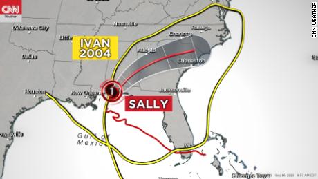
Sally is the fourth hurricane to make landfall in the US this year — the most by this point in a year since 2004. It also is the eighth named storm to make landfall in the US, the most by September 16 on record.
Residents prepared for a serious storm
People began preparing for Sally over the weekend, filling sandbags, grabbing supplies and prepping their homes.
Merrill Warren of Summerdale, Alabama, which sits about 16 miles inland from the Gulf, told CNN he brought in furniture, purchased gas and other supplies, and got his generator ready for the storm.
On Tuesday night, he reported that heavy rains and winds of up to 39 mph had already hit inland. Warren was more concerned about the potential for increased rainfall and surges than anything else, he said.
“This isn’t the first Category 1 hurricane that I have been through. I have been there through Hurricane Nate and Tropical Storm Gordon,” Warren said. “I’m more worried about the rain for this one. … The rain and storms surge are definitely going to be the bigger issue with a storm moving at 2 mph.”
CNN’s Michelle Krupa, Hollie SIlverman, Gary Tuchman, Ed Lavandera, Gabe Ramirez, David Williams, Brandon Miller and Alisha Ebrahimji contributed to this report.
![]()


